
Start a Bentonville Street Search
A street address is a key, not a final answer. Benton County parcel records identify land and ownership, while voter, permit, deed, and directory sources record different events. Begin with the full house number, directional prefix, road name, and suffix. Bentonville uses NW, NE, SW, and SE prefixes, so dropping the quadrant can join two unrelated places. Keep the search narrow until the county map confirms the right parcel.
The Bentonville address workflow should preserve every role. An owner may receive tax mail elsewhere. A deed records a transaction, not a household. A permit may name a contractor. A voter entry reflects one registered voter and excludes many other people. Use this order to keep those facts apart:
- Run the full physical address in the Benton County parcel application. Save the parcel ID, subdivision, lot or block, and current owner.
- Compare the physical, or situs, address with the owner mailing address. Treat a mismatch as normal, not as an error.
- Follow the assessor record to its deed book and page or instrument reference. Use that reference at the Recorder's Office.
- Check the lawfully available voter file, permits, and dated directories for evidence tied to the same place and period.
- Confirm any conclusion with at least one source of a different kind and note the date of each record.
The result is a chain of dated links. It is more useful than a loose name match because each step stays attached to the same Bentonville parcel.
Search Bentonville Streets by Field
The county parcel app exposes distinct search layers. Address search accepts a substring of the full address. Parcel search accepts a parcel ID, owner, or address. Other layers search plats, streets, subdivisions, section maps, and rural scans. Results can be printed or exported to CSV, and a selected row zooms to the feature. Those controls make a whole-street review possible without assuming that every mapped owner lives on the parcel.
| Search layer | Input | Returned details |
|---|---|---|
| Address | Full or partial street address | Number, direction, road, type, unit, city, ZIP |
| Parcels | Parcel ID, owner, or address | Owner, parcel, address, acres, subdivision, S-T-R |
| Plat scans by parcel | Parcel, owner, or address | Plat, book, page, subdivision, linked PDF |
| Streets | Street name | Road, highway number, ownership |
| Subdivisions | Subdivision name | Named subdivision result |
The separate Benton County Assessor Property Search adds basic fields for parcel number, parcel type, owner's name, street number, direction, street name, exact spelling, city, and mailing information. Paid tools add sale, deed, lot, block, size, and improvement fields.
The assessor interface shows how Bentonville address research starts online.
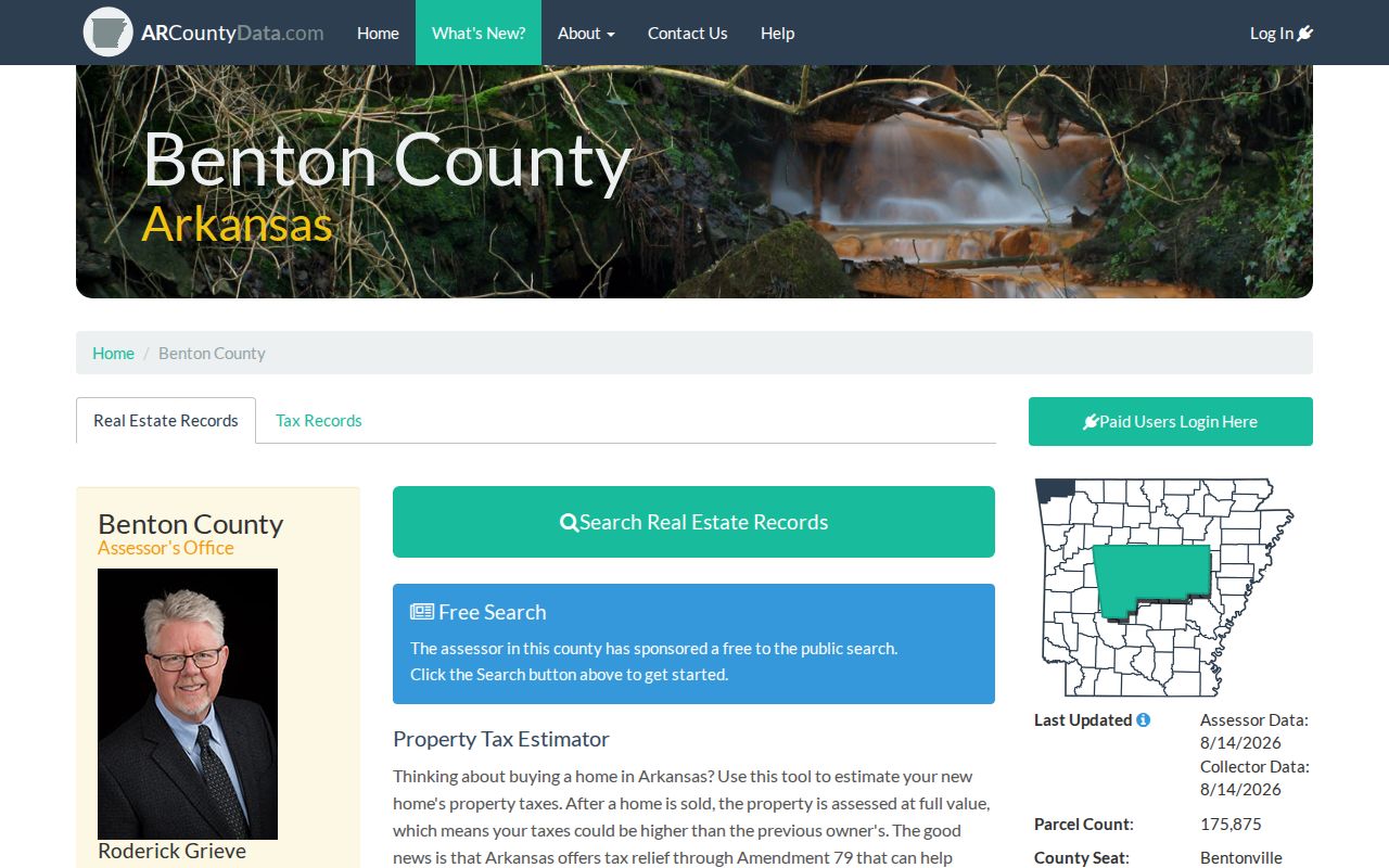
Its owner and address inputs help move from a known location to a dated parcel record, but the county warns that online data is working information.
Bentonville Street Records by Source
Each address-keyed source answers a different question. The parcel roll is strongest for current assessed ownership. The GIS connects that roll to mapped land. Recorder documents supply the transfer chain. Voter data can show permitted registration facts. Permits date work at the site. Historical directories may supply a past subscriber or occupant. The Bentonville address index is reliable only when those roles are not blended.
| Record set | Keeper | Street evidence | Access |
|---|---|---|---|
| Property roll | Benton County Assessor | Owner, situs, mailing, parcel, legal description, values | Web search or assessor office |
| Parcel and street GIS | Benton County GIS | Mapped parcels, roads, plats, subdivision and S-T-R | Public interactive map |
| Recorded instruments | Circuit Clerk Recorder | Parties, legal description, book/page or instrument | BIS, counter, or copies |
| Voter file | Secretary of State or County Clerk | Permitted name, residence, precinct and district fields | Statutory request; protected addresses excluded |
| Building permits | City of Bentonville | Address-linked work, permit number and status | Public GIS layer and city records |
| Historical directories | Library and museum collections | Dated subscriber or occupant entries | On site or licensed database |
When an online tool fails, the access chain continues. The Assessor's Bentonville office can explain parcel data. The Recorder's counter supplies older books and copies. The County Clerk handles voter-file requests. Library and museum collections cover older address evidence. A focused Arkansas Freedom of Information Act request can seek an identifiable existing city or county record, but it cannot require staff to create a household list.
Note: Record the access date because Bentonville ownership, permits, registration facts, and street geography can change at different speeds.
Read Bentonville Street Directory Terms
Four terms keep address research precise. They explain why a mailing line, a mapped point, and a deed description may refer to the same property without saying the same thing.
- Parcel
- A mapped unit of land tied to a county identifier and assessment record.
- Situs address
- The physical location of the parcel, which may differ from the owner's tax-mailing address.
- Plat
- A recorded map showing a subdivision, lots, blocks, roads, and other legal geography.
- Criss-cross directory
- A dated directory arranged by street or telephone number rather than only by surname.
Legal description is the durable bridge. If an address changes or a parcel is split, the lot, block, subdivision, or section-township-range can keep the deed chain connected. City street GIS also stores left and right address ranges, direction, type, venue, optional ZIP, and postal city. Opposite sides of one road may therefore have different address attributes.
The Bentonville street GIS service publishes that schema.
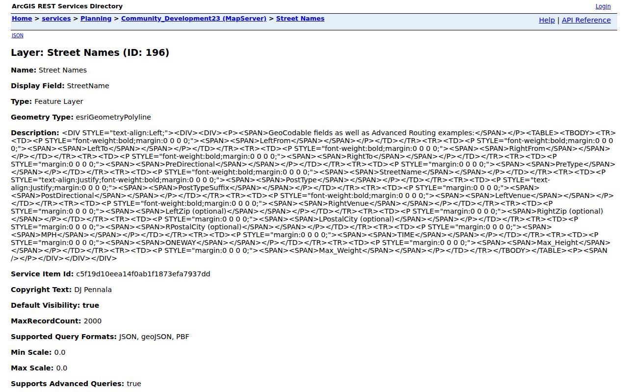
The field list shows why direction, side of street, ZIP, and postal city should remain separate during a by-address search.
Bentonville Streets Have Three Identities
Owner mailing address, situs address, and occupant are three different propositions. The lightweight county map table labels owner mailing as OW_ADD and physical address as PH_ADD. They can match, but often do not. Homestead status may appear on the fuller assessor record. Even when the mailing and situs lines match, the roll still names an assessed owner rather than every person at the address.
That distinction matters on a fast-growing Bentonville block. A sale, reassessment, new permit, and voter update may each carry a different date. Read each date before connecting a person to a place. Parcel ID and legal geography support the property match, while a second, independently kept source supports a person match.
Key distinction. A parcel owner is not automatically an occupant, and the absence of a name from one roll does not prove absence from the address.
Walk a Bentonville Street Deed Chain
Once the parcel is certain, the recorder trail moves back through ownership. Open the current assessor reference. At the Recorder, identify the seller, called the grantor. Then search that seller as the grantee, or buyer, in an earlier instrument. Repeat while the legal description still matches. This method avoids a false chain built from people with similar names.
The Benton County recorder search FAQ reports deed-index coverage from May 3, 1945 forward and deed images from January 31, 1933 forward. Instruments before October 30, 2017 use book and page; later instruments use a number beginning with L. Series dates differ, and county summaries conflict, so confirm the needed record type before paying.
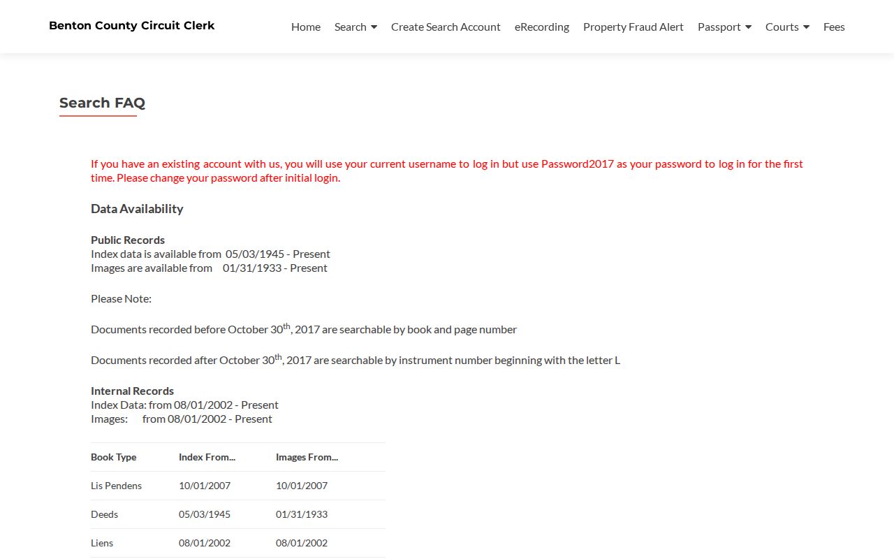
The recorder notice is a useful cutoff chart, not proof that a particular document is online.
Web access includes an $80 monthly search-and-image plan, a $150 bulk-image plan, or pay-as-you-go images at $0.25 per page. At the Recorder's Office, ordinary copies cost $0.25 per page, while a certified recorded-document copy starts at $5 plus $0.25 for each later page. The counter at 215 E. Central Avenue, Room 202, is open Monday through Friday, 8:00 a.m. to 4:30 p.m.; call 479-271-1017.
The BIS recorded-document gateway is the online entry.
Its document route complements the parcel roll by showing the recorded transfer behind a current owner entry.
Bentonville Street Records Before 1945
The online cutoff does not end a by-address search. The Benton County Historical Society bridges early eras with personal-tax surname indexes from 1837 through 1899, real-estate tax indexes for the same span, town lot and block material from 1871 through 1899, assessor books, deed indexes and books from parts of 1900 through 1919, and plats spanning 1837 through 2015. Its wider room includes printable deed film, censuses, obituaries, newspapers, and the 1903 Original Assessor's Atlas.
Visit the Society at 306 NW 2nd Street, Tuesday through Friday from 10:00 a.m. to 3:00 p.m., or call 479-273-3561. The Recorder counter remains the first stop for older official books. Dated directories and Sanborn maps then help relate an old lot or building to people, but those sources should not replace the deed or tax evidence.
For deeper work with historical occupants rather than modern parcels, the Bentonville city directory collections deserve their own edition-by-edition review.
Layer Permits on Bentonville Streets
A permit can date construction or a later change. Bentonville's building-permit feature layer supports queries and maps permit points by status. It may connect an address with a permit number, work, applicant, or contractor. None of those roles proves who occupied the property. Used with the parcel record, however, the permit can explain why the assessed improvement or building footprint changed.
The Bentonville building-permit layer exposes the public service and its query capability.
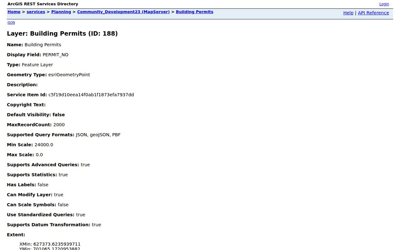
The service gives a dated construction layer for the address index while keeping property work separate from household evidence.
Code cases follow another route. Existing, nonexempt address-keyed records may be requested from the city, but active enforcement and personal details can be withheld. Ask for a defined address, date span, and record type. This gives staff a record to locate rather than asking the city to research a street for you.
Note: Bentonville has not published an earliest permit-layer year in the inspected sources, so never assume the absence of a digital point means no permit existed.
Voter Data Along Bentonville Streets
VoterView is an identity-gated individual tool. It requires first name, last name, and date of birth, and it cannot browse a street. For block or street analysis, Arkansas law provides a separate electronic list route. Ark. Code Ann. § 7-5-109 requires the county clerk to provide a voter list with at least permitted name, address, and precinct fields, while secure-voter addresses stay excluded.
A lawfully obtained file may be sorted by residential address, ZIP, and precinct. Presence means that a registered voter appears in the dated file. It does not list every adult, renter, child, or other household member. Participation history can show whether a voter took part in a federal election since 2008, but never reveals ballot choices. Contact the Benton County Clerk at 215 E. Central Avenue, 479-271-1013, for the county route, or use the Secretary of State request form for state data.
Maximum county electronic-list fees are $10 for up to 5,000 records, $25 for 5,001 through 25,000, and $50 above 25,000. Use only the minimum fields needed and do not republish protected or sensitive data.
Bentonville Street Directory Boundaries
No public address index proves a complete current household. Parcel records omit many occupants and may name an owner elsewhere. Voter records omit nonvoters and secure-voter addresses. DMV data is restricted by the federal Driver's Privacy Protection Act. Utility customers, delivery data, private neighborhood rosters, renters, and household members are not supplied by the parcel workflow. A historical directory remains a dated publication, not a present claim.
Commercial compilations can merge sources of mixed age and may attach one person's name to another person's address. Official records have narrower meanings but clearer custodians and dates. When a source record is wrong, ask the Assessor, Recorder, County Clerk, or City office that maintains it about correction. Do not treat a compiled listing as stronger than the underlying record.
Lawful use. Bentonville address records support family history, property research, civic review, and personal safety. Never use them to stalk, harass, threaten, or evade protected-record rules.
A whole named street can contain hundreds of different legal and human stories. Preserve the source date, the person's role, and the exact parcel. That discipline is what turns a Bentonville address search into a record trail rather than a guess.