
Find Bentonville Neighbors by Block
The public trail around one Bentonville address is layered. County GIS shows the shape and placement of parcels. The assessor roll supplies assessed owners and separates the physical parcel from the owner's tax-mailing address. A permitted voter file can add registered voters, but it excludes secure-voter addresses and is not a census. The city's Great Neighborhoods program describes organizations and their boundaries, while directories and maps provide dated evidence for older blocks.
Begin with the source that fits the question. A property line belongs in GIS. Current ownership belongs in the assessor roll. A subdivision or plat belongs in mapped and recorded land records. Civic contact belongs with the neighborhood group. The table keeps the proof and the limit side by side.
| Source | What it shows about a block | Access |
|---|---|---|
| Benton County parcel GIS | Parcel shape, owner, situs, acreage, subdivision, S-T-R | Public map, searchable and exportable |
| Assessor property roll | Owner, tax mailing, physical location, values, legal details | Web search or assessor office |
| Arkansas voter file | Permitted voter name, residence and precinct fields | Request and fee rules; protected data excluded |
| Great Neighborhoods | Organization, boundaries, public contact and group activity | City program and registration route |
| Permits and plats | Construction points, subdivisions, lots, blocks and roads | City layer, county GIS, Recorder |
| Historical collections | Dated occupants, structures, maps and local context | Library, museum, historical society |
These sources describe the block from different angles. None is a complete roster of nearby residents, and none should be presented as one.
Map Bentonville Neighbors Within 300 Feet
The county parcel app can build an adjacent-parcel set from one address. Search the exact location first and select its result. The Text, Graphical, and Spatial tabs then offer different ways to define the block. Spatial search is the cleanest route for a radius. Official help illustrates a 300-foot buffer, while the control accepts another distance and unit when the research calls for a tighter area.
- Open the Benton County parcel application, find the address, and confirm the selected parcel.
- Choose Spatial, enter 300 feet, click Apply Buffer, and set Parcels as the target layer.
- Use Intersect By for parcels that touch the buffer or Contain By for features inside it.
- Review the result grid, zoom to each parcel, and export CSV only if the table is needed for lawful personal research.
- Compare physical and owner-mailing addresses, then note that mapped ownership is not proof of occupancy.
The official parcel search configuration records the layers and returned fields.
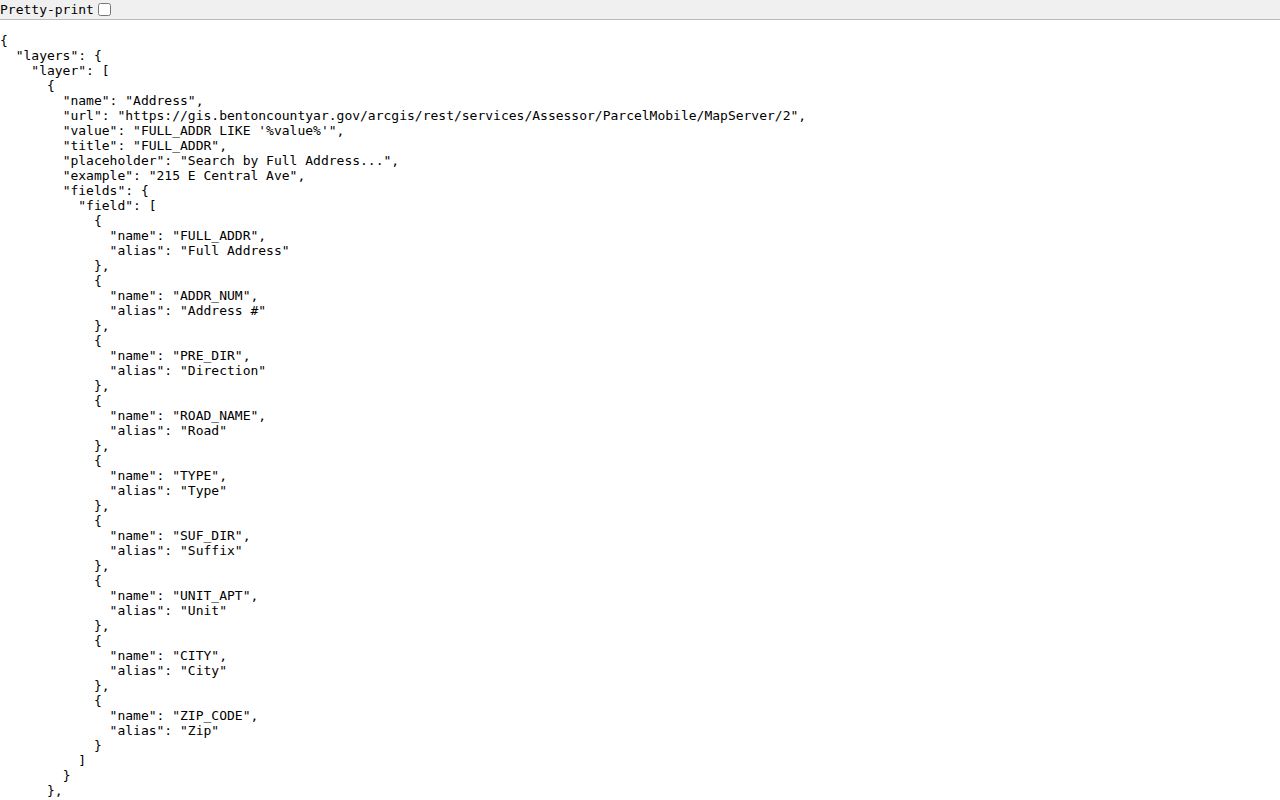
The configuration confirms how address, parcel, plat, street, subdivision, and rural-scan searches connect to the mapped block.
Graphical search offers another route. Select Parcels and use Point for one feature, or Polyline and Polygon to draw a group. Results can be printed, exported, cleared, selected, and zoomed. For the full chain across an entire named road, shift to the Bentonville street directory workflow instead of stretching a neighbor buffer beyond its purpose.
Separate Bentonville Owners and Residents
A parcel result can display owner, parcel ID, physical address, acreage, type, section-township-range, subdivision, and school code. The county schema keeps owner mailing and physical address in separate fields. A fuller assessor record may add homestead status, sale information, improvements, deed reference, values, and assessment history. That is strong property evidence, but it still does not name every person who lives there.
A matching mailing address can support an owner-occupancy inference. Homestead status may add context. Neither proves the full household. An owner can live elsewhere; a trust or company can hold title; unrelated people can share a home; and renters may be absent from the roll. Nearby Bentonville residents should be described only as specifically as the source allows.
- Adjacent owner
- The assessed owner of a parcel beside or near the starting property.
- Situs
- The physical parcel address, distinct from the address used for tax correspondence.
- Buffer
- A measured area drawn around a point or feature to select nearby map records.
- Homestead status
- An assessor field that may support owner occupancy but does not list all residents.
Note: Date the parcel card because a sale or parcel split can change the owner, legal description, and map geometry.
Bentonville Neighborhood Groups Organize
The Great Neighborhoods Partnership is the city's framework for newly forming associations, existing associations, property owners' associations, and homeowners' associations. It grew from 27 to 36 partners during 2024. That count reflects organizations, not household members, and a registered partner is not a public roll of everyone inside its boundary.
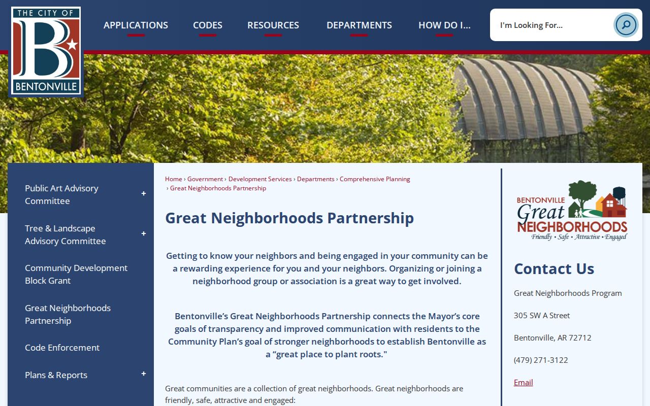
The program provides a civic entry point for public group information and neighborhood-level communication.
The city distinguishes a voluntary neighborhood association from a deed-created POA or HOA. The first is a civic group that residents choose to join. The latter may carry recorded covenants and mandatory duties. Bentonville enforces public ordinances, not private covenants. For boundary help or program questions, contact Comprehensive Planning at 479-271-3122 or neighborhoods@bentonvillear.com.
Great Neighborhoods
City partnership for associations, POAs, and HOAs. Use it for registered organization information and program participation.
Comprehensive Planning
Helps with neighborhood mapping and program questions. Phone: 479-271-3122. Email: neighborhoods@bentonvillear.com.
Benton County GIS
Maps parcels, streets, subdivisions, plats, and selected features around the starting address.
Bentonville Neighbor Registration Fields
A Great Neighborhoods registration captures organization-level facts. Fields include the group's name and type; north, south, east, and west boundaries or a map; household count; ZIP; communication methods; meeting dates, attendance, and minutes. Existing groups may also upload board names, titles, emails, bylaws, and event evidence. Those fields show how an organization works. They do not turn the city's program into a member directory.
Communication choices listed on the form include email, a social group, webpage, neighborhood platform, newsletters, fliers or mailers, group text, word of mouth, and other methods. A public board contact may be used to ask about an event or civic concern. Private rosters and contact lists should stay private.
The Great Neighborhoods registration form displays the organization and activity fields.
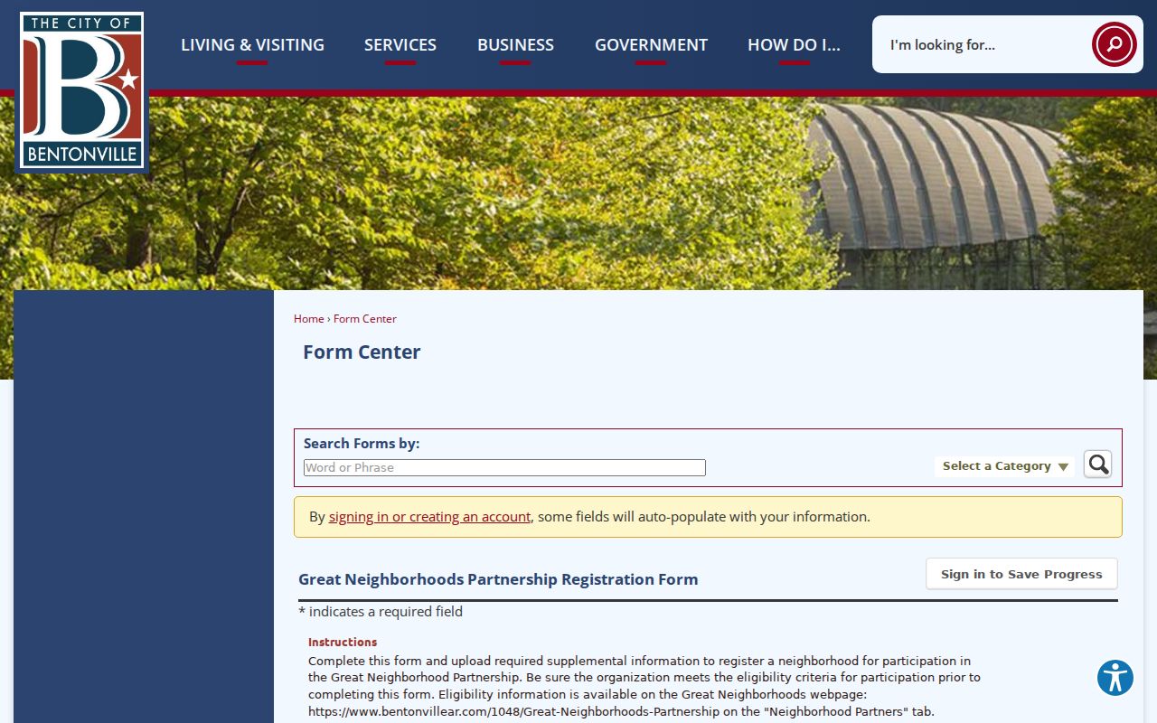
The form makes the boundary between public program data and private household membership clear.
Read Bentonville Blocks in Voter Data
VoterView cannot search a block. It requires an individual's first name, last name, and full date of birth. Arkansas provides a separate list process for broader address or precinct analysis. Under Ark. Code Ann. § 7-5-109, the county electronic list contains at least permitted name, address, and precinct fields, while secure-voter addresses are excluded. The Secretary of State file can also contain voter ID, county, residence or mailing address, phone, date of birth, districts, and date last voted, subject to law and release rules.
A lawful file can be sorted by residential address or precinct. It still does not list every neighbor. Children, eligible nonregistrants, renters who have not updated registration, and protected voters may be absent. Election participation history does not disclose ballot choices. Use the least data needed, and never republish dates of birth, phone numbers, or protected fields.
County electronic-list fees are capped at $10 for up to 5,000 records, $25 for 5,001 through 25,000, and $50 for larger files. Request local records from the Benton County Clerk at 215 E. Central Avenue, 479-271-1013. The office is open 8:00 a.m. to 4:30 p.m. and through lunch.
Compare Bentonville Neighbor Sources
Official sources are narrow but accountable. A parcel roll has a custodian, a record date, and a defined purpose. A voter file has statutory fields and exclusions. A neighborhood registration describes a group. Commercial neighbor tools may blend these with older or nonpublicly sourced data, then present the mix without clear dates. That broad result can look complete while being less precise.
| Source type | Strength | Limit |
|---|---|---|
| County parcel and assessor | Mapped land, assessed owner, legal and mailing fields | Owner is not the same as occupant |
| Permitted voter data | Dated registration and precinct facts | Not every resident; protected addresses excluded |
| City neighborhood program | Organization boundary and civic contacts | Not a household or membership roster |
| Commercial compilation | May combine many categories quickly | Mixed-age data, unclear sourcing, same-name errors |
When an official record is wrong, contact its custodian. The Assessor handles parcel-roll corrections, the County Clerk handles voter records, and city planning handles Great Neighborhoods data. Fixing the source is more useful than correcting only a copied listing.
Protect Bentonville Neighbors' Privacy
Block research stops where the public record stops. Parcel owners may be public, but renters and household members are not exposed by the county parcel workflow. Secure-voter addresses remain confidential. Utility-customer and delivery data do not belong in a neighbor lookup. Private association rosters, group messages, and contact lists are also different from the public organization fields submitted to the city.
Arkansas does not have a verified broad statewide substitute-address program in the inspected official sources. Record-specific safeguards still matter, including secure-voter treatment, sealed court records, adoption and juvenile rules, restricted vital records, and federal driver-record protections. Never infer that one protection applies to every source, and never try to route around it.
Lawful use. Use Bentonville neighbor records for civic curiosity, reconnecting, local history, and personal safety. Never watch, threaten, harass, intimidate, or expose a protected person.
The careful result is modest: a mapped set of nearby parcels, named assessed owners where available, permitted voter evidence, and public organization contacts. It can explain the block without claiming to identify every Bentonville neighbor who lives there.