
Bentonville Previous Resident Sources
An address trail changes by era. The current parcel record supplies the first owner and legal description. The recorder links that owner to earlier sellers. Historic tax, plat, and deed holdings then bridge the web cutoff. Directories and census schedules shift the question from ownership to households, while maps and permits tell what changed at the site. The strongest past-household account uses at least one property source and one people source.
| Source | Years it covers | Where held | What it shows |
|---|---|---|---|
| Assessor and parcel GIS | Current roll; older depth varies | Benton County web tools and office | Owner, parcel, situs, mailing address, legal geography |
| Recorder deed index and images | Index from 1945; images from 1933 | BIS and Recorder counter | Ownership chain and instrument references |
| Tax, assessor, deeds, and plats | Tax and assessor 1837 to 1899; named deed and plat series vary | Benton County Historical Society | Earlier owner and lot or block trail |
| Directories and telephone books | Verified locally from 1904; full run not posted | Rogers museum and library databases | Dated occupant or subscriber clues |
| Federal census | Public schedules through 1950 | Library genealogy databases and archives | Household at an enumeration date |
| Sanborn maps and permits | Sanborn 1886 to 1940; permit start not stated | Library of Congress, museum, and city GIS | Building form, use, alterations, and permit parties |
For a recent Bentonville address, begin online. For an older downtown lot, expect to move between plats, courthouse books, historical society indexes, and directories. Never turn an owner into an occupant without a second source.
Start Bentonville Address History Today
The Benton County Assessor Property Search can accept parcel number, owner name, street number, direction, street name, and city. The county GIS also searches parcels through one box for parcel ID, owner, or address. A returned row may include owner, parcel ID, physical address, acres, subdivision, section-township-range, and school code. Save the parcel ID, lot and block or land description, current owner, deed reference, and both address fields.
The assessor search screenshot shows the official starting point for Bentonville address history.
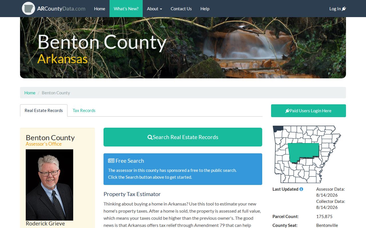
Watch the split between owner mailing address and physical, or situs, address. They may differ. Situs means the place of the parcel; mailing means where tax mail goes. Neither field alone proves who lived there before.
The county parcel search configuration confirms separate Address, Parcels, Plat Scans, Streets, Subdivisions, and section-map searches.
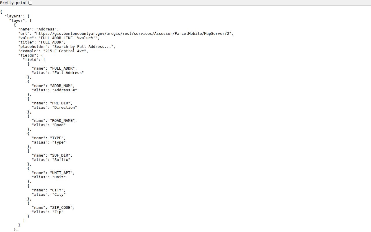
Those paths help when a street spelling fails. A plat scan or subdivision search can preserve the land identity after the street number changes.
Trace Bentonville Owners Through Deeds
The current deed reference opens the backward chain. The Benton County Recorder search FAQ reports deed-index coverage from May 3, 1945 to the present and deed images from January 31, 1933. Series dates differ, and an older official summary gives narrower online dates. Confirm the exact record type and date before paying.
The recorder coverage screen makes that series-by-series caution visible.
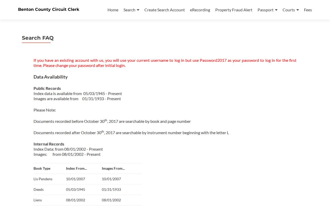
Instruments before October 30, 2017 use book and page for retrieval. Later items carry an instrument number beginning with L. That cutover changes the search reference, not the basic backward method.
- Copy the current owner, parcel, legal description, and deed reference from the assessor.
- Retrieve the current purchase deed and identify its grantor, the seller.
- Search that seller as a grantee, the buyer, to locate the earlier acquisition.
- Repeat while names, legal descriptions, and references still connect.
- At the online limit, continue through recorder books and historical society holdings.
The Recorder counter is at 215 E. Central Avenue, Room 202, and is open Monday through Friday, 8 a.m. to 4:30 p.m.; recording closes at 4:15 p.m. Call 479-271-1017. Online access is offered by subscription or pay-per-view, while counter copies and mail requests provide direct fallbacks. Confirm the needed reference, fee, and mailing steps with staff first.
- Grantor and grantee
- The grantor gives an interest; the grantee receives it.
- Chain of title
- The linked sequence of transfers for the same parcel.
- Legal description
- The lot, block, subdivision, or land description that can outlast a street number.
Bentonville Records Cross the Web Cutoff
The BIS recorded-document gateway is only one access channel. Web searching costs more than a free index: the published options include an $80 monthly search-and-image plan, a $150 monthly plan with bulk image downloads, or 25 cents per page for pay-as-you-go image viewing. At the office, ordinary copies are 25 cents per page; a certified recorded-document copy is $5 plus 25 cents for each later page. Confirm current charges before ordering.
The BIS gateway image identifies the online route for Bentonville deed research.
For early address history, Benton County Historical Society is the major bridge. Its holdings include tax and assessor indexes from 1837 through 1899, town lot and block indexes from 1871, deed film from 1837, selected direct and indirect deed indexes and books, and original plats through 2015. The room at 306 NW 2nd Street is listed as open Tuesday through Friday, 10 a.m. to 3 p.m.
Note: Online absence may signal a date or series limit, so check the counter and archival chain before concluding no deed exists.
Keep Bentonville Land Identity Stable
Street numbers and parcel IDs can fail across time. A parcel may be split, combined, or replatted. A subdivision name can change how an older book describes the same ground. The safer continuity anchor is the legal description tied to plats and deeds. Bentonville also uses NW, NE, SW, and SE street prefixes, so dropping the quadrant can point to another place.
The search flow is compact: current address to parcel ID, parcel ID to legal description, legal description to deed, deed seller to earlier purchase. When that flow breaks, search the subdivision, lot and block, or section-township-range. Ask GIS or recorder staff when the current parcel did not exist in an older instrument.
First-owner work can reach even farther. Benton County Archives advertises a First Lot Owners in Bentonville, Arkansas, 1837 to 1845 resource, shown in its collection overview.
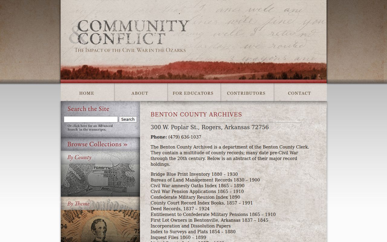
The list belongs beside the original town plat and early assessor or tax books, not as a stand-alone claim about who occupied a lot.
Place Bentonville Past Residents at Home
Deeds trace owners. Former occupants require the household layer. Local city and business telephone directories are verified at Rogers Historical Museum from at least 1904, though the full run is not published. Public federal census schedules run through 1950. The 1890 population schedules were largely destroyed nationwide, which makes directories, tax rolls, deeds, and newspapers crucial in that gap.
Pair sources in a fixed order:
- Choose an owner period from the deed chain and note its exact bounds.
- Check the nearest directory for the street or surname, including spelling variants.
- Compare the closest public census and copy every member of the household.
- Use newspapers, yearbooks, probate, and obituaries to explain a change.
- Mark each fact with its date and source role.
A criss-cross directory begins with street and house number, then names the listed occupant or subscriber. A standard name-order book starts with the person. Neither proves a full household. The collections and reading rules belong to the Bentonville city directory research path.
Nine Bentonville Address Maps Track Buildings
Bentonville Sanborn editions survive for 1886, 1892, 1897, 1904, 1908, 1914, 1922, 1933, and 1940. They form a rare visual timeline for a downtown or historic address. A sheet may show the building footprint, construction material, use, and close structures. It dates the structure, not the prior residents.
Match a directory address to the correct sheet index, then compare lot lines with the 1903 Benton County plat map. If a number or street name has shifted, return to the legal lot and block. No authoritative citywide street-renumbering year was found, so a mismatch should be investigated rather than assigned an invented date.
The maps are available through the Library of Congress sequence and at Rogers Historical Museum. A museum visit can also add named and place files, newspapers, and photographs to the same address search.
Bentonville Address Permits Date Changes
The city's Building Permits feature layer can date work at an address. Its public status symbols include received, shell complete, temporary certificate issued, under review, void, and withdrawn. A permit point may connect a property with an applicant or contractor, but that party is not always a past resident. The earliest online permit year was not stated in the source.
The permit layer screenshot shows the address-linked Bentonville change record.
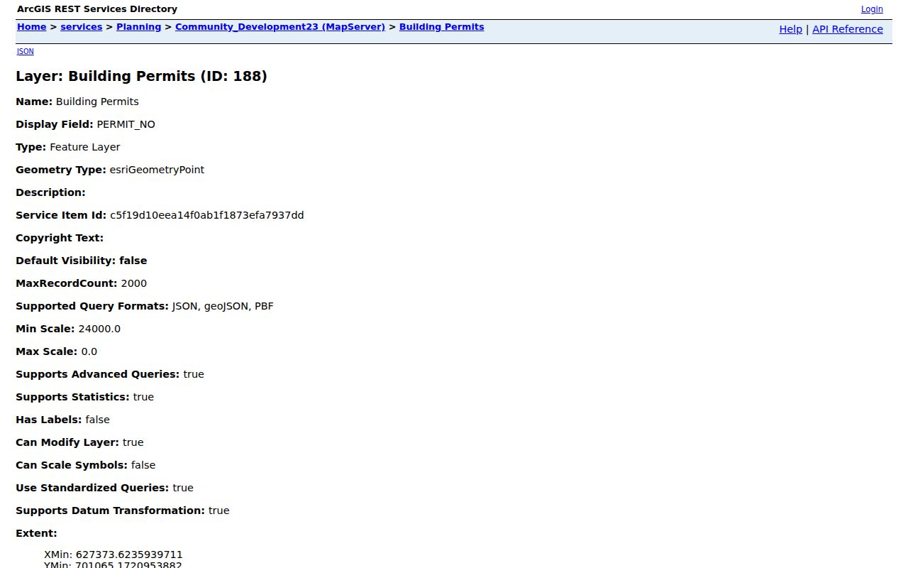
Use a permit to explain why a footprint changed between maps or why a deed mentions a new lot improvement. Planning and Development Services works from 3200 SW Municipal Drive and lists 479-271-3122, Monday through Friday, 8 a.m. to 4:30 p.m. The public map and staff contact are both valid fallbacks.
Close Bentonville Resident Trails
When a former owner or occupant disappears, check the Rogers museum obituary volumes, newspaper runs, funeral-home and cemetery records, and the Benton County Probate Division. Probate may identify heirs or a personal representative, though sealed or confidential filings remain unavailable. Bentonville Cemetery's GIS can add mapped block, lot, space, cremation, or linked-photo context to a deceased-person lead.
The Probate Division is at 102 NE A Street, Room 206, and lists 479-271-5727. Its counter is open 8 a.m. to 4 p.m. and closed from noon to 1 p.m. CourtConnect supplies an index path, but the clerk holds the case file and copies. An obituary is a family clue, not a substitute for the filed case.
Lawful use. Research former occupants for Bentonville house history, family work, or personal curiosity. Never use a living person's trail to stalk, harass, or cause harm.